Ein 'Arik
Ein 'Arik | |
|---|---|
| Transkripsi Arab | |
| • Arab | عين عريك |
 Ein 'Arik | |
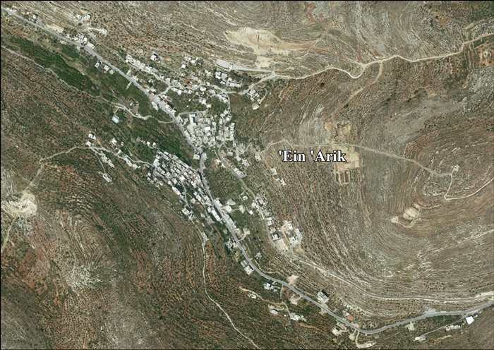
 Ein 'Arik Lokasi Ein 'Arik di Palestina | |
| Koordinat: 31°54′24″N 35°08′35″E / 31.90667°N 35.14306°E | |
| Grid Palestina | 163/145 |
| Negara | |
| Kegubernuran | Ramallah dan al-Bireh |
| Pemerintahan | |
| • Jenis | Dewan desa |
| Populasi (2007) | |
| • Total | 1.567 |
Ein 'Arik (bahasa Arab: عين عريك) adalah sebuah kota Palestina di Kegubernuran Ramallah dan al-Bireh, yang berjarak 7 kilometer dari barat Ramallah di utara Tepi Barat. Menurut Biro Pusat Statistik Palestina, kota tersebut memiliki populasi 1.567 penduduk yang terdiri dari Muslim (65%) dan Nasrani (35%) pada 2007.[1]
Referensi
- ^ 2007 PCBS Census Diarsipkan December 10, 2010, di Wayback Machine. Palestinian Central Bureau of Statistics. p. 114.
Daftar pustaka
- Barron, J.B., ed. (1923). Palestine: Report and General Abstracts of the Census of 1922. Government of Palestine.
- Conder, C.R.; Kitchener, H.H. (1883). The Survey of Western Palestine: Memoirs of the Topography, Orography, Hydrography, and Archaeology. Vol. 3. London: Committee of the Palestine Exploration Fund.
- Dauphin, Claudine (1998). La Palestine byzantine, Peuplement et Populations. BAR International Series 726 (dalam bahasa French). Vol. III : Catalogue. Oxford: Archeopress. ISBN 0-860549-05-4. Pemeliharaan CS1: Bahasa yang tidak diketahui (link)
- Finkelstein, I.; Lederman, Zvi, ed. (1997). Highlands of many cultures. Tel Aviv: Institute of Archaeology of Tel Aviv University Publications Section. ISBN 965-440-007-3.
- Government of Jordan, Department of Statistics (1964). First Census of Population and Housing. Volume I: Final Tables; General Characteristics of the Population (PDF).
- Government of Palestine, Department of Statistics (1945). Village Statistics, April, 1945.
- Guérin, V. (1875). Description Géographique Historique et Archéologique de la Palestine (dalam bahasa French). Vol. 2: Samarie, pt. 2. Paris: L'Imprimerie Nationale. Pemeliharaan CS1: Bahasa yang tidak diketahui (link)
- Hadawi, S. (1970). Village Statistics of 1945: A Classification of Land and Area ownership in Palestine. Palestine Liberation Organization Research Center.
- Hartmann, M. (1883). "Die Ortschaftenliste des Liwa Jerusalem in dem türkischen Staatskalender für Syrien auf das Jahr 1288 der Flucht (1871)". Zeitschrift des Deutschen Palästina-Vereins. 6: 102–149.
- Hütteroth, Wolf-Dieter; Abdulfattah, Kamal (1977). Historical Geography of Palestine, Transjordan and Southern Syria in the Late 16th Century. Erlanger Geographische Arbeiten, Sonderband 5. Erlangen, Germany: Vorstand der Fränkischen Geographischen Gesellschaft. ISBN 3-920405-41-2.
- Mills, E., ed. (1932). Census of Palestine 1931. Population of Villages, Towns and Administrative Areas. Jerusalem: Government of Palestine.
- Palmer, E.H. (1881). The Survey of Western Palestine: Arabic and English Name Lists Collected During the Survey by Lieutenants Conder and Kitchener, R. E. Transliterated and Explained by E.H. Palmer. Committee of the Palestine Exploration Fund.
- Pringle, Denys (2009). The Churches of the Crusader Kingdom of Jerusalem: The cities of Acre and Tyre with Addenda and Corrigenda to Volumes I-III. Vol. IV. Cambridge University Press. ISBN 978-0-521-85148-0.
- Robinson, E.; Smith, E. (1841). Biblical Researches in Palestine, Mount Sinai and Arabia Petraea: A Journal of Travels in the year 1838. Vol. 2. Boston: Crocker & Brewster.
- Robinson, E.; Smith, E. (1841). Biblical Researches in Palestine, Mount Sinai and Arabia Petraea: A Journal of Travels in the year 1838. Vol. 3. Boston: Crocker & Brewster.
- Schick, C. (1896). "Zur Einwohnerzahl des Bezirks Jerusalem". Zeitschrift des Deutschen Palästina-Vereins. 19: 120–127.
- Socin, A. (1879). "Alphabetisches Verzeichniss von Ortschaften des Paschalik Jerusalem". Zeitschrift des Deutschen Palästina-Vereins. 2: 135–163.
Pranala luar
- Welcome To 'Ayn 'Arik
- Ein ‘Arik, Welcome to Palestine
- Survey of Western Palestine, Map 17: IAA, Wikimedia commons
- Ain Arik Parish Diarsipkan 2019-12-05 di Wayback Machine., Latin Patriarchate
- 'Ein 'Arik Village (Fact Sheet), Applied Research Institute–Jerusalem (ARIJ)
- ‘Ein ‘Arik Village Profile, ARIJ
- 'Ein 'Arik, aerial photo, ARIJ
- Locality Development Priorities and Needs in ‘Ein ‘Arik Village, ARIJ
- Ein Arik Diarsipkan 2017-09-13 di Wayback Machine., Unispal
- Civil Administration nixes order to take land for settlement road, June 14, 2012, The Times of Israel

| Basis data pengawasan otoritas: Nasional |
|---|
Content Disclaimer
Informasi ini disarikan dari Wikipedia dan disajikan kembali untuk tujuan edukasi. Konten tersedia di bawah lisensi CC BY-SA 3.0. Kami tidak bertanggung jawab atas ketidakakuratan data yang bersumber dari kontribusi publik tersebut.
- The information displayed on this website is sourced in part or in whole from Wikipedia and has been adapted for the purpose of restating it. We strive to provide accurate and relevant information, however:
- There is no guarantee of absolute accuracy. Wikipedia is an open, collaborative project that can be edited by anyone, so information is subject to change.
- It is not intended to constitute professional advice. The content displayed is for informational and educational purposes only. For important decisions (e.g., medical, legal, or financial), please consult a professional.
- Content copyright. Wikipedia is licensed under the Creative Commons Attribution-ShareAlike License (CC BY-SA). This means that content may be reused with appropriate attribution and shared under a similar license.
- Responsible use. Any risk arising from the use of information from this website is entirely the responsibility of the user.