Nasipit
| Artikel ini tidak memiliki kotak info. Anda mungkin ingin menambahkan sebuah kotak info, agar artikel menyerupai tampilan standar untuk topik ini. Halaman pembicaraan ini mungkin berisi spanduk proyek relevan yang menyediakan kotak info standar untuk jenis artikel ini. Lihat pula Kategori:Templat kotak info dan Wikipedia:ProyekWiki Kotak info. |

Nasipit adalah munisipalitas yang terletak di provinsi Agusan del Norte, Filipina.
Pada tahun 2011, munisipalitas ini memiliki penduduk sebesar 34.233 jiwa atau 6.561 rumah tangga.[1]
Sejarah
Nasipit resmi dibentuk sebagai munisipalitas di provinsi Agusan pada 1 Agustus 1929 melalui Executive Order No. 181 yang dikeluarkan oleh Pelaksana Tugas Gubernur Jenderal Filipina, Eugene Allen Gilmore. Munisipalitas ini merupakan hasil pemekaran dari Butuan.
Melalui Republic Act No. 380 yang dikeluarkan pada 15 Juni 1949, Nasipit dimekarkan untuk membentuk munisipalitas baru yang bernama Carmen.
Setelah provinsi Agusan dipecah menjadi dua, yaitu Agusan Utara dan Agusan Selatan pada 17 Juni 1967 melalui Republic Act No. 4969, Nasipit menjadi bagian dari provinsi Agusan Utara.
Pembagian wilayah
Nasipit terbagi menjadi 19 barangay. yaitu:
| Barangay | Penduduk (2007) |
|---|---|
| Aclan | |
| Amontay | |
| Ata-Atahon | |
| Camagong | |
| Cubi-Cubi | |
| Culit | |
| Jaguimitan | |
| Kinabjangan | |
| Barangay 1 Poblacion | |
| Barangay 2 Poblacion | |
| Barangay 3 Poblacion | |
| Barangay 4 Poblacion | |
| Barangay 5 Poblacion | |
| Barangay 6 Poblacion | |
| Barangay 7 Poblacion | |
| Punta | |
| Santa Ana | |
| Talisay | |
| Triangulo |
Daftar sekolah
Berikut ini adalah nama-nama sekolah yang ada di Nasipit, yaitu:
- West Nasipit Central Elementary School
- Saint Michael College of Caraga
- Northwestern Agusan Colleges
- Punta Elementary School
- Talisay Elementary School
- Camagong Elementary School
- East Central - Kinabjangan Elementary School
- Aclan Elementary School
- Ata-Atahon Elementary School
- Jaguimitan Elementary School
- Sta. Ana Elementary School
- Triangulo Elementary School
- Cubi-Cubi Elementary School
- Amontay Elementary School
- Culit Elementary School
- Nasipit Institute of Technology (NIT)
- Jaguimitan National High School
- Culit National High School
- Liceo de Agusan
- Nasipit National High School (NNHS/IS)
- Nasipit National Vocational School
- Northwestern Agusan Colleges
- Nasipit Institute
- Pacifican Institute of Agusan
- Saint Michael College of Caraga
- Virginia Institute of Technology
Galeri
-
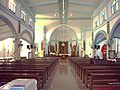 Bagian dalam Saint Michael Parish di Nasipit pada masa lalu, sekarang telah dicat ulang menjadi warna kuning.

Referensi
- ^ "Local Governance Performance Management System". Diarsipkan dari asli tanggal 2016-03-04. Diakses tanggal 2012-09-07.
Pranala luar
- Situs web resmi
- Situs web resmi St. Michael College of Caraga Diarsipkan 2020-02-07 di Wayback Machine.
- Philippine Standard Geographic Code Diarsipkan 2012-04-13 di Wayback Machine.
- 1995 Philippine Census Information Diarsipkan 2011-06-24 di Wayback Machine.
- 2000 Philippine Census Information Diarsipkan 2010-01-30 di Wayback Machine.
- 2007 Philippine Census Information (1) Diarsipkan 2008-11-20 di Wayback Machine.
- 2007 Philippine Census Information (2) Diarsipkan 2012-09-10 di Wayback Machine.
8°58′08″N 125°17′42″E / 8.969°N 125.295°E
| Munisipalitas | |
|---|---|
| Kota komponen | |
| Kota sangat urban | Butuan (Secara administratif independen dari provinsi, namun oleh National Statistics Office dimasukkan ke Agusan del Norte) |
Artikel bertopik geografi atau tempat Filipina ini adalah sebuah rintisan. Anda dapat membantu Wikipedia dengan mengembangkannya. |
Content Disclaimer
Informasi ini disarikan dari Wikipedia dan disajikan kembali untuk tujuan edukasi. Konten tersedia di bawah lisensi CC BY-SA 3.0. Kami tidak bertanggung jawab atas ketidakakuratan data yang bersumber dari kontribusi publik tersebut.
- The information displayed on this website is sourced in part or in whole from Wikipedia and has been adapted for the purpose of restating it. We strive to provide accurate and relevant information, however:
- There is no guarantee of absolute accuracy. Wikipedia is an open, collaborative project that can be edited by anyone, so information is subject to change.
- It is not intended to constitute professional advice. The content displayed is for informational and educational purposes only. For important decisions (e.g., medical, legal, or financial), please consult a professional.
- Content copyright. Wikipedia is licensed under the Creative Commons Attribution-ShareAlike License (CC BY-SA). This means that content may be reused with appropriate attribution and shared under a similar license.
- Responsible use. Any risk arising from the use of information from this website is entirely the responsibility of the user.