There are several hypothetical possibilities for the origin of the modern name of the city, which is first mentioned under it in the 9th century. One possibility is that the name might be an Arab phonetic transcription of a pre-existing toponym. However, there is no name that fully qualifies as such, apart from the Ariza (Ancient Greek: Αριζα) of Hierokles, which is difficult to interpret.
Another possibility is that the name el-Arish was given to a city that already existed in the Byzantine period. However, no Arab source mentions such a change of name for any city in the region, and there is no plausible explanation for this change.
A third possibility is that the name el-Arish was created when a new settlement of some "huts" (Arabic: عرش, romanized: ʕarš) was established in the 7th or 8th century. It is possible that the city of Rinokoloura fell into ruins in the first half of the 7th century, and a new community arose that the new inhabitants started to call el-Arish, after their poor living conditions.[4]
M. Ignace de Rossi derived the Arabic name from the Egyptian ϫⲟⲣϣⲁ(ⲓ), 'noseless', an analogue of Greek Rinocorura.[5]
A Coptic-Arabic colophon dating to 1616 mentions the writer "Solomon of Shorpo, son of Michael, from the city of Mohonon" (ⲥⲱⲗⲟⲙⲟⲛ ⲛϣⲱⲣⲡⲟ ⲡϣⲏⲣⲓ ⲙⲓⲭⲁⲏⲗ ⲛⲧⲉ ⲡⲟⲗⲓⲥ ⲙⲟϩⲟⲛⲟⲛ); in the Arabic version, the writer is identified as being "of el-Arish".[6] Timm raises the possibility that Shorpo (Coptic: ϣⲱⲣⲡⲟ) may be another name for el-Arish.
Geography
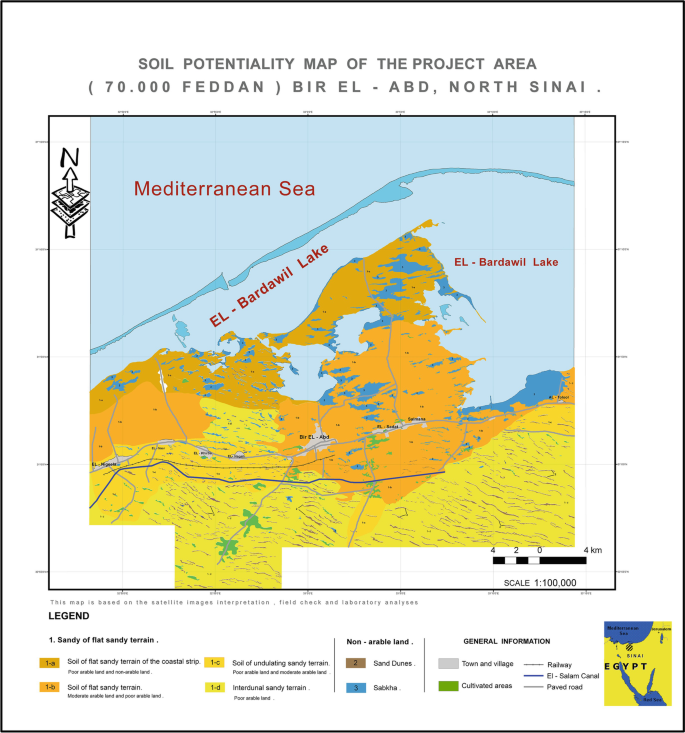
Arish is in the northern Sinai, about 50 kilometres (31 mi) from the Rafah Border Crossing with the Gaza Strip.[7] North Sinai is targeted by Egyptian government planners to divert population growth from the high-density Nile Delta. It is proposed that by completing infrastructure, transportation and irrigation projects, three million Egyptians may be settled in North Sinai.[8]
The highest record temperature was 45 °C (113 °F), recorded on May 29, 2003, while the lowest record temperature was −6 °C (21 °F), recorded on January 8, 1994.[9]
The city is the site of a deep-water seaport capable of serving ships up to 30,000 tonnes, the only such port on the Sinai Peninsula. Its major exports are cement, sand, salt and marble.[15] The Sinai White Cement Company plant is 50 kilometres (31 mi) south of the city.[16]
History
Herodotus describes a city named Ienysos (Ancient Greek: Ιηνυσος) located between Lake Serbonis and Kadytis. It is possible that Ienysos is the predecessor of Rinokoloura, but there is no clear evidence to support this identification.[17]
Foundation
The foundation of the city is closely linked to the etymology of its name. The explanation given by the classic authors is that it comes from a compound of "nose" (Ancient Greek: ῥίς) and "curtail, cut short" (Ancient Greek: κολούω).
Thus modern scholars, following the version given by Seneca, believe that in the 4th century BC, a Persian king, believed to be either Artaxerxes II or Artaxerxes III, conducted a campaign in Syria where he punished people, possibly a tribe, by mutilating their noses. As a result, the places where these people came from or relocated to were given new names that reflected their disfigurement. While the Greek name Rinokoloura may have existed from the outset, it is possible that it was a translation of a name with the same meaning in another language.
When the city became a part of the Ptolemaic Empire, an Egyptian tradition emerged that may have transformed the Persian king into an Ethiopian king named Actisanes. First mentioned by Diodorus, who based his information on the Aegyptiaca of Hecataeus of Abdera, written in the 4th century BC, Actisanes conquered Egypt during the reign of king Amasis. He governed Egypt with justice and benevolence, and instead of executing convicted criminals, he had their noses cut off and relocated them to a city at the desert's edge, near the border between Egypt and Syria.[18]
The Oxyrhynchus papyrus,[clarification needed] traditionally referred to as 'an invocation of Isis' or 'a Greek Isis litany,' is believed to have been transcribed during the reigns of Trajan or Hadrian, but its composition dates back to the late 1st century. This text contains numerous invocations of Isis and mentions Rinokoloura, where she is called 'all-seeing' (Ancient Greek: παντόπτιν).[19]
A number of funerary steles with a repeated consolation formula "nobody is immortal" (Ancient Greek: ούδείς άθάνατος) were found in and around the city.
The earliest reliable Christian reference to Rinokoloura can be found in Athanasius'sEpistula ad Serapionem, in which Salomon was appointed as bishop of Rinokoloura, possibly in 339 AD. Sozomen also refers to Rinokoloura in the mid-5th century AD, stating that the city was a center of scholarship, with a meditation school (Ancient Greek: φροντιστήριον) located in the desert north of the city, a church illuminated by oil lamps, and an episcopal dwelling where the entire clergy of the city resided and dined together.[20]
Hieronymus reported that in the early 5th century the inhabitants of Rinokoloura and other nearby cities spoke Syrian. However, as most of the epitaphs discovered in the area are written in Greek, and one is in Coptic, it is unclear which segment of the population Hieronymus was referring to.[21]
According to John of Nikiu, in 610 AD the army of general Bonosos passed through Rinocoroura (mentioned under the corrupted name Bikuran) on its way to Athribis.[22]
The Brook of Egypt
The story of Hesychios of Jerusalem reveals the existence of a wadi near Rinokoloura. In one instance, the Septuagint (Isaiah 27:12)[23] translates 'the brook of Egypt,' which designates the southern border of Israel, as Rinokoloura, suggesting that the translators were perhaps aware of a similar 'brook' in the vicinity of the city. However, it appears that the association between Rinokoloura and the 'brook of Egypt' may be due more to the contemporary political border between Egypt and Syria, which had shifted further southward since the 8th century AD.
After the Arab Conquest
In the Middle Ages, pilgrims misidentified the site as the Sukkot of the Bible.[4] New fortifications were constructed at the original site by the Ottoman Empire in 1560. During the Napoleonic Wars, the French laid siege to the fort, which fell after 11 days on February 19, 1799.
During World War I, the fort was destroyed by British bombers. It was later the location of the 45th Stationary Hospital which treated casualties of the Palestine campaign. The remains of those who died there were later moved to Kantara Cemetery.
Anti-aircraft guns of an Australian Light Horse regiment near the beach at 'Arish, during World War I.Members of the Harel Brigade at 'Arish airfield, during the 1948 Palestine war.
El-ʻArīsh Military Cemetery, designed by Robert Lorimer,[25] was built in 1919 for Commonwealth personnel who died during World War I. It is one of several commonwealth war cemeteries in the region, including two in the Gaza Strip.
A Royal Air Force airfield,[where?] known as RAF El Arish, was a base for air sea rescue and other operations, during World War II.
Israeli conquest 1948 to 1967
ʻArīsh was briefly controlled by Israeli forces, during both the 1948 Palestine war and the 1956 Suez War. On December 8, 1958, there was an air battle between Egyptian and Israeli air forces over ʻArīsh.[26] As a result of the 1967 Arab-Israeli War, 'Arish was under Israeli occupation; it was returned to Egypt in 1979 after the signing of the Egypt–Israel peace treaty.
Some speculate that this might have been the notice for the attacks on the USS Liberty, which was passing close to Arish when it was attacked.[28]
Conservative Israeli media and the Boston-based pro-Israel media advocacy organization "CAMERA" deny that there was a "massacre".[29][30]
In 1995 two mass graves from 1967 were found near Arish, see below.[31][32][33]
ISIS in the Sinai Peninsula
On 24 November 2017, in the Sinai mosque attack, 305 people were killed in a bomb and gun attack at the mosque in al-Rawda, 45 kilometres (28 mi) west of ʻArīsh.[34][35]
On 9 February 2021 six locals were killed by ISIL terrorists.[36]f
In 1995 two mass graves were found near Arish.[33] An expedition was sponsored by al-Ahram, Cairo's government-run newspaper found mass graves of Egyptian POWs from 1967.[31][38]
^Verreth, Herbert (2006). The northern Sinai from the 7th century BC till the 7th century AD. A guide to the sources. Vol. 1. Leuven. p. 293.
^Charles, Robert H (1913). The Chronicle of John, Bishop of Nikiu: Translated from Zotenberg's Ethiopic Text. p. 207.
^Meer, Michaël N. van der. "The Natural and Geographical Context of the Septuagint: Some Preliminary Observations". In W. Kraus; M. Karrer; M. Sigismund (eds.). Die Septuaginta. Entstehung, Sprache, Geschichte. 3. Internationale Fachtagung veranstaltet von Septuaginta Deutsch (LXX.D), Wuppertal 22.-25. Juli 2010 (WUNT I 286; Tübingen; Mohr-Siebeck, 2012). pp. 387–421.
Piala Liga PortugalMulai digelar2007Wilayah PortugalJumlah tim32Juara bertahanBragaTim tersuksesBenfica (4 gelar)Televisi penyiarSIC dan SportTVSitus webhttp://www.lpfp.pt Piala Liga Portugal 2013–14 Piala Liga Portugal (Portugis: Taça da Ligacode: pt is deprecated ) adalah kejuaraan sepak bola yang diselenggarakan di Portugal. Kejuaraan ini dimulai sejak tahun 2007.[1] Daftar juara Musim Juara Skor Runner up Tanggal Stadion 2007–08 Vitória de Setúbal 0 – 0 (3 – 2)…
beIN Sports ArabiaDiluncurkan1 Januari 2014JaringanAl JazeeraPemilikAl Jazeera Media NetworkSloganChange the game.NegaraQatarBahasaArabInggrisKantor pusatDoha, QatarSitus webwww.ar.beinsports.netTelevisi Internet BeIN Sports Arabia (Arab: الجزيرة الرياضيةcode: ar is deprecated ) adalah saluran olahraga berbahasa Arab. Sebelumnya saluran ini beroperasi sebagai Al Jazeera Sports. Channel beIN Sports News SD (free-to-air) beIN Sports News HD (free-to-air) beIN Sports HD (free-to-air)…
Sistem penentuan seks haplodiploid dapat ditemui dalam lebah dan tawon. Haplodiploid adalah sistem penentuan seks yang menghasilkan jantan dari telur yang belum difertilisasi (sehingga haploid) dan betina dari telur yang telah difertilisasi (sehingga diploid).[1] Sistem penentuan seks ini dapat ditemui dalam semua anggota ordo serangga Hymenoptera (lebah, semut, dan tawon),[2] Coccidae,[3] dan Thysanoptera.[4] Sistem ini juga dapat ditemui dalam beberapa Tetranych…
Dewan Perwakilan Rakyat Kota Sabang DPRK Sabang2019-2024JenisJenisUnikameral Jangka waktu5 tahunSejarahSesi baru dimulai2 September 2019PimpinanKetuaMuhammad Nasir (Partai Aceh) sejak 21 Oktober 2019 Wakil Ketua IArmadi (Demokrat) sejak 21 Oktober 2019 Wakil Ketua IIFerdiansyah (Golkar) sejak 21 Oktober 2019 KomposisiAnggota20Partai & kursi NasDem (1) Demokrat (2) PAN (1) Golkar (2) PBB (2) PKS (1) …
American politician (1868–1950) Henry F. LawrenceMember of the U.S. House of Representativesfrom Missouri's 3rd districtIn officeMarch 4, 1921 – March 3, 1923Preceded byJacob L. MilliganSucceeded byJacob L. Milligan Personal detailsBorn(1868-01-31)January 31, 1868near Greensburg, IndianaDiedJanuary 12, 1950(1950-01-12) (aged 81)Cameron, MissouriPolitical partyRepublican Henry Franklin Lawrence (January 31, 1868 – January 12, 1950) was a U.S. Representative from Mi…
RadenDjoeanda Kartawidjaja ᮏᮥᮃᮔ᮪ᮓ ᮊᮁᮒᮝᮤᮏᮚ Perdana Menteri Indonesia ke-11Masa jabatan9 April 1957 – 6 Juli 1959 PendahuluAli SastroamidjojoPenggantiSoekarnoMenteri Pertama IndonesiaMasa jabatan9 Juli 1959 – 7 November 1963 PendahuluTidak ada; jabatan baruPenggantiJabatan dihapuskanMenteri Keuangan Indonesia Ke-11Masa jabatan10 Juli 1959 – 6 Maret 1962PresidenSoekarno PendahuluSutikno SlametPenggantiR.M NotohamiprodjoMenteri Perta…
This article has multiple issues. Please help improve it or discuss these issues on the talk page. (Learn how and when to remove these template messages) This article may require cleanup to meet Wikipedia's quality standards. The specific problem is: Almost nothing in this article is formatted to fit Wikipedia. Please help improve this article if you can. (August 2020) (Learn how and when to remove this template message) This article needs additional citations for verification. Please help impro…
La strada di casaPaeseItalia Anno2017-2019 Formatoserie TV Generedramma familiare, giallo Stagioni2 Episodi24 Durata50 min (episodio) Lingua originaleitaliano Rapporto16:9 CreditiIdeatoreFrancesco Arlanch, Andrea Valagussa RegiaRiccardo Donna SceneggiaturaFrancesco Arlanch, Andrea Valagussa, Maura Nuccetelli, Elisa Zagaria Interpreti e personaggi Alessio Boni: Fausto Morra Lucrezia Lante della Rovere: Gloria Sergio Rubini: Ernesto Baldoni Thomas Trabacchi: Michele Paolo Graziosi: Elia Fattor…
Swedish boxer Thure AhlqvistPersonal informationBorn20 April 1907Borås, SwedenDied20 March 1983 (aged 75)Borås, SwedenSportSportBoxingClubIK Ymer, Borås Medal record Representing Sweden Olympic Games 1932 Los Angeles lightweight Thure Johan Ahlqvist (20 April 1907 – 20 March 1983) was a Swedish lightweight boxer who won a silver medal at the 1932 Summer Olympics. A tall and mobile boxer, Ahlqvist favored fighting at a distance, occasionally throwing straight punches.[1][2&…
2009 studio album by Alicia KeysThe Element of FreedomStandard edition cover[a]Studio album by Alicia KeysReleasedDecember 11, 2009 (2009-12-11)RecordedMay–December 2009Studio Germano[b] Manhattan Sound Recordings[c] Oven[d] Strawberrybee[e] (New York City) Pie[f] (Glen Cove) Conway[g] Larrabee[h] (Los Angeles) Genre R&B pop soul Length53:04LabelJProducer Alicia Keys Jeff Bhasker Kerry Brothers Jr. Toby …
Cricket competition in Australia Sheffield ShieldCountries AustraliaAdministratorCricket AustraliaFormatFirst-classFirst edition1892–93Latest edition2023–24Tournament formatDouble round-robin, then finalNumber of teams6Current champion Western Australia (18th title)Most successful New South Wales (47 titles)Most runsDarren Lehmann (South Australia and Victoria)12,971 runsMost wicketsClarrie Grimmett (Victoria and South Australia)513 wicketsTVCricket NetworkKayo SportsFox Crick…
Pour les articles homonymes, voir Müller. Annette MullerBiographieNaissance 15 mars 193312e arrondissement de ParisDécès 9 août 2021 (à 88 ans)Le Blanc-MesnilNom dans la langue maternelle Anna MullerNationalité françaiseActivité ÉcrivaineAutres informationsGenre artistique AutobiographieŒuvres principales La petite fille du Vel' d'Hiv', 1991modifier - modifier le code - modifier Wikidata Annette Bessmann, née Anna Muller le 15 mars 1933 à Paris 12e et morte le 9 août 2021 …
Disambiguazione – Se stai cercando altri significati, vedi Pepoli (disambigua). Questa voce o sezione sull'argomento storia di famiglia è priva o carente di note e riferimenti bibliografici puntuali. Sebbene vi siano una bibliografia e/o dei collegamenti esterni, manca la contestualizzazione delle fonti con note a piè di pagina o altri riferimenti precisi che indichino puntualmente la provenienza delle informazioni. Puoi migliorare questa voce citando le fonti più precisamente. Segui i…
Questa voce o sezione sull'argomento linguisti russi non cita le fonti necessarie o quelle presenti sono insufficienti. Puoi migliorare questa voce aggiungendo citazioni da fonti attendibili secondo le linee guida sull'uso delle fonti. Romа́n Ósipovič Jakobsòn Romа́n Ósipovič Jakobsòn (in russo Рома́н О́сипович Якобсо́н?; Mosca, 10 ottobre 1896 – Cambridge, 18 luglio 1982) è stato un linguista, semiologo e traduttore russo naturalizzato statunitense,…
English noblewoman (1776–1856) Charlotte OsborneCharlotte, Duchess of Leeds, by Anne MeeDuchess consort of LeedsTenure1799 - 1838 BornLady Charlotte Townshend16 March 1776Died30 July 1856 (aged 80)Noble familyTownshendSpouse(s)George Osborne, 6th Duke of LeedsIssueFrancis D'Arcy-Osborne, 7th Duke of LeedsLady Charlotte Mary Anne Georgiana OsborneLord Conyers George Thomas William OsborneFatherGeorge Townshend, 1st Marquess TownshendMotherAnne Montgomery Charlotte Osborne, Duchess of Leeds …
The State TheatreAddress130 West College AvenueState College, Pennsylvania United StatesOwnerThe State Theatre, Inc.OperatorThe State Theatre, Inc.Capacity554Current useCommunity theatre (since 2006)OpenedOctober 15, 1938Websitewww.thestatetheatre.org The State Theatre is a 554-seat non-profit community theatre in State College, Pennsylvania.[1] It currently operates as one of the cultural hubs of music, cinema, and live performances for downtown State College and the Centre County …
Lambang Botswana Lambang negara Botswana adalah lambang resmi dari Botswana. Format terkini lambang ini diresmikan pada 25 Januari 1966. Struktur Perisai tengah disokong dua ekor zebra. Bentuk perisai mengikuti perisai tradisional Afrika Timur. Di bagian atas perisai terdapat tiga roda yang melambangkan industri. Tiga gelombang air menyimbolkan air, dan menunjukkan motto nasional: pula, yang berarti hujan, atau juga berarti keberuntungan, dan merupakan nama uang nasional. Motto ini juga melamban…

.svg)


")