Custer County, Montana
County in Montana, United States
County in Montana
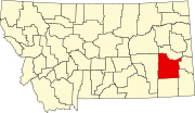
Custer County is a county located in the U.S. state of Montana . As of the 2020 census , the population was 11,867.[1] county seat is Miles City .[2] Territory of Montana named Big Horn County ,[3] Lieutenant Colonel George Armstrong Custer .[4]
Geography
According to the United States Census Bureau , the county has a total area of 3,793 square miles (9,820 km2 ), of which 3,783 square miles (9,800 km2 ) is land and 9.9 square miles (26 km2 ) (0.3%) is water.[5]
Climate
According to the Köppen Climate Classification system, Custer County has a mostly cold semi-arid climate , abbreviated "BSk" on climate maps.
Climate data for Mizpah, Montana, 1991—2020 normals, extremes 1960—present
Month
Jan
Feb
Mar
Apr
May
Jun
Jul
Aug
Sep
Oct
Nov
Dec
Year
Record high °F (°C)
69
73
85
92
101
111
112
110
106
96
80
70
112
Mean maximum °F (°C)
51.6
56.3
71.9
81.3
87.2
95.8
102.5
101.5
97.1
84.2
67.9
54.2
104.4
Mean daily maximum °F (°C)
32.6
36.9
49.7
61.2
70.9
81.1
91.3
90.9
79.4
62.1
46.4
35.2
61.5
Daily mean °F (°C)
19.4
23.7
35.4
46.1
55.8
65.6
73.5
72.0
61.0
46.2
32.3
21.9
46.1
Mean daily minimum °F (°C)
6.3
10.6
21.0
31.0
40.8
50.1
55.6
53.0
42.6
30.4
18.3
8.6
30.7
Mean minimum °F (°C)
−23.5
−15.4
−4.1
13.1
24.3
36.1
43.2
37.6
25.5
12.3
−6.3
−17.2
−32.0
Record low °F (°C)
−45
−45
−40
−5
13
21
33
31
16
−11
−29
−49
−49
Average precipitation inches (mm)
0.44
0.48
0.70
1.65
2.92
2.31
1.78
1.02
1.26
1.04
0.50
0.41
14.51
Average snowfall inches (cm)
5.6
5.0
5.4
2.2
0.8
0.0
0.0
0.0
0.1
1.6
3.7
5.5
29.9
Average precipitation days (≥ 0.01 in)
6.2
6.3
6.3
8.4
10.5
10.4
8.0
5.8
6.3
7.2
5.7
5.9
87.0
Average snowy days (≥ 0.1 in)
4.7
4.4
3.2
1.3
0.3
0.0
0.0
0.0
0.0
1.0
3.2
4.8
22.9
Source 1: NOAA[6]
Source 2: National Weather Service[7]
Major highways
Transit
Adjacent counties
Demographics
Historical population
Census Pop. Note %± 1870 38 — 1880 2,510 6,505.3% 1890 5,308 111.5% 1900 7,891 48.7% 1910 14,123 79.0% 1920 12,194 −13.7% 1930 11,242 −7.8% 1940 10,422 −7.3% 1950 12,661 21.5% 1960 13,227 4.5% 1970 12,174 −8.0% 1980 13,109 7.7% 1990 11,697 −10.8% 2000 11,696 0.0% 2010 11,699 0.0% 2020 11,867 1.4% 2022 (est.) 12,032 [8] 1.4%
2020 census
As of the 2020 census , there were 11,867 people living in the county.[citation needed
2010 census
As of the 2010 census , there were 11,699 people, 5,031 households, and 3,014 families living in the county. The population density was 3.1 inhabitants per square mile (1.2/km2 ). There were 5,560 housing units at an average density of 1.5 per square mile (0.58/km2 ). The racial makeup of the county was 95.5% white, 1.7% American Indian, 0.3% black or African American, 0.3% Asian, 0.1% Pacific islander, 0.5% from other races, and 1.6% from two or more races. Those of Hispanic or Latino origin made up 2.2% of the population. In terms of ancestry, 33.6% were German , 18.3% were Irish , 14.3% were American , 14.1% were Norwegian , and 10.6% were English .
Of the 5,031 households, 27.3% had children under the age of 18 living with them, 46.6% were married couples living together, 9.0% had a female householder with no husband present, 40.1% were non-families, and 34.3% of all households were made up of individuals. The average household size was 2.24 and the average family size was 2.88. The median age was 42.1 years.
The median income for a household in the county was $38,913 and the median income for a family was $49,011. Males had a median income of $37,535 versus $26,576 for females. The per capita income for the county was $21,676. About 12.4% of families and 15.7% of the population were below the poverty line , including 19.8% of those under age 18 and 14.6% of those age 65 or over.
Politics
United States presidential election results for Custer County, Montana[13]
Year
Republican
Democratic
Third party
No.
%
No.
%
No.
%
2020 4,205
71.76%
1,514
25.84%
141
2.41%
2016 3,657
70.53%
1,176
22.68%
352
6.79%
2012 3,373
62.87%
1,833
34.17%
159
2.96%
2008 3,047
55.89%
2,267
41.58%
138
2.53%
2004 3,297
65.31%
1,630
32.29%
121
2.40%
2000 3,156
64.34%
1,501
30.60%
248
5.06%
1996 2,467
46.29%
2,115
39.69%
747
14.02%
1992 2,105
37.52%
1,968
35.07%
1,538
27.41%
1988 3,007
55.05%
2,343
42.90%
112
2.05%
1984 3,879
65.53%
1,982
33.49%
58
0.98%
1980 3,533
60.75%
1,822
31.33%
461
7.93%
1976 3,120
55.25%
2,425
42.94%
102
1.81%
1972 3,486
63.31%
1,875
34.05%
145
2.63%
1968 2,831
58.06%
1,760
36.10%
285
5.84%
1964 2,302
45.13%
2,790
54.70%
9
0.18%
1960 2,943
55.00%
2,393
44.72%
15
0.28%
1956 3,240
58.30%
2,317
41.70%
0
0.00%
1952 3,461
62.53%
2,050
37.04%
24
0.43%
1948 1,845
43.28%
2,359
55.34%
59
1.38%
1944 1,830
46.96%
2,038
52.30%
29
0.74%
1940 2,017
41.73%
2,782
57.55%
35
0.72%
1936 1,381
29.30%
3,196
67.81%
136
2.89%
1932 1,675
36.99%
2,729
60.27%
124
2.74%
1928 2,503
64.08%
1,386
35.48%
17
0.44%
1924 1,654
43.78%
412
10.91%
1,712
45.31%
1920 2,347
64.53%
1,127
30.99%
163
4.48%
1916 1,615
37.05%
2,602
59.69%
142
3.26%
1912 695
21.70%
1,068
33.34%
1,440
44.96%
1908 967
60.66%
531
33.31%
96
6.02%
1904 824
72.22%
285
24.98%
32
2.80%
1900 980
66.94%
477
32.58%
7
0.48%
1896 723
51.50%
676
48.15%
5
0.36%
1892 680
52.67%
537
41.60%
74
5.73%
Economy
Agriculture (dryland farming ) and cattle raising provide the bulk of Custer County economy.[14] [15] [15]
Communities
County Courthouse in Miles City
City
Town
Unincorporated communities
See also
References
^ a b "State & County QuickFacts" . United States Census Bureau. Retrieved April 5, 2023 .^ "Find a County" . National Association of Counties. Archived from the original on May 31, 2011. Retrieved June 7, 2011 .^ Big Horn County, Montana Territory was not the same county as present day Big Horn County, Montana .^ "A Brief Custer County History" . Custer County Montana. Archived from the original on October 28, 2014. Retrieved December 1, 2014 .^ "2010 Census Gazetteer Files" . United States Census Bureau. August 22, 2012. Archived from the original on December 5, 2014. Retrieved November 27, 2014 .^ "U.S. Climate Normals Quick Access" . National Oceanic and Atmospheric Administration. Retrieved August 6, 2022 .^ "NOAA Online Weather Data" . National Weather Service. Retrieved August 6, 2022 .^ "Annual Estimates of the Resident Population for Counties: April 1, 2020 to July 1, 2022" . United States Census Bureau. Retrieved April 5, 2023 .^ "U.S. Decennial Census" . United States Census Bureau. Retrieved November 27, 2014 .^ "Historical Census Browser" . University of Virginia Library. Archived from the original on August 11, 2012. Retrieved November 27, 2014 .^ "Population of Counties by Decennial Census: 1900 to 1990" . United States Census Bureau. Retrieved November 27, 2014 .^ "Census 2000 PHC-T-4. Ranking Tables for Counties: 1990 and 2000" (PDF) . United States Census Bureau. Archived (PDF) from the original on March 27, 2010. Retrieved November 27, 2014 .^ Leip, David. "Atlas of US Presidential Elections" . uselectionatlas.org . Retrieved April 2, 2018 . ^ Merrill, Andrea; Judy Jacobson (1997). Montana almanac . Helena MT: Falcon Publishing. ISBN 1-56044-493-2 ^ a b Montana Dept. of Labor and Industry (September 2010). "Demographic & Economic Information for Custer County" (PDF) . Archived from the original (PDF) on September 6, 2011. Retrieved July 23, 2011 . ^ U.S. Geological Survey Geographic Names Information System: Garland ^ U.S. Geological Survey Geographic Names Information System: Garland ^ U.S. Geological Survey Geographic Names Information System: Garland ^ U.S. Geological Survey Geographic Names Information System: Tusler
Places adjacent to Custer County, Montana
46°16′N 105°35′W / 46.27°N 105.58°W / 46.27; -105.58