Bradlo
| Państwo | |
|---|---|
| Pasmo | |
| Wysokość |
840 m n.p.m. |
Położenie na mapie Słowacji 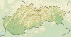 | |
Bradlo – szczyt górski w Górach Tokajsko-Slańskich we wschodniej Słowacji. 840 m n.p.m. Zalesiony. Ze szczytu w sprzyjających warunkach można dostrzec Tatry[1], Bieszczady[2] oraz inne pasma Karpat Wschodnich, m.in. Popa Iwana Marmaroskiego[3].
Przez szczyt nie biegnie żaden znakowany szlak turystyczny. Jego podnóża okrążają ![]() Ruská Nová Ves – Tri Chotáre – przełęcz Červená mlaka – przełęcz Grimov laz – Makovica – Mošník – Przełęcz Herlańska – Lazy – Przełęcz Slańska – Slanec i
Ruská Nová Ves – Tri Chotáre – przełęcz Červená mlaka – przełęcz Grimov laz – Makovica – Mošník – Przełęcz Herlańska – Lazy – Przełęcz Slańska – Slanec i ![]() ze wsi Vyšná Myšľa.
ze wsi Vyšná Myšľa.
Przypisy
Bibliografia
- Rudolf Buday, Ľudmila Citoríková, Zdeněk Šír (red.) Slanské vrchy. Dargov. Turistická mapa. 1:50.000, 1. vydanie, Vojenský Kartografický Ústav š.p., Harmanec 1999, ISBN 80-8042-018-1
- Juraj Kordováner, Zdeněk Šír (red.) Slanské vrchy. Veľká Domaša. Turistická mapa. 1:50.000, 2. vydanie, VKÚ a.s., Harmanec 2003, ISBN 80-8042-017-3
Content Disclaimer
Informasi ini disarikan dari Wikipedia dan disajikan kembali untuk tujuan edukasi. Konten tersedia di bawah lisensi CC BY-SA 3.0. Kami tidak bertanggung jawab atas ketidakakuratan data yang bersumber dari kontribusi publik tersebut.
- The information displayed on this website is sourced in part or in whole from Wikipedia and has been adapted for the purpose of restating it. We strive to provide accurate and relevant information, however:
- There is no guarantee of absolute accuracy. Wikipedia is an open, collaborative project that can be edited by anyone, so information is subject to change.
- It is not intended to constitute professional advice. The content displayed is for informational and educational purposes only. For important decisions (e.g., medical, legal, or financial), please consult a professional.
- Content copyright. Wikipedia is licensed under the Creative Commons Attribution-ShareAlike License (CC BY-SA). This means that content may be reused with appropriate attribution and shared under a similar license.
- Responsible use. Any risk arising from the use of information from this website is entirely the responsibility of the user.