Kraj Loary
| region | |||||

| |||||
| |||||
| Państwo | |||||
|---|---|---|---|---|---|
| Siedziba | |||||
| Kod ISO 3166-2 |
FR-PDL | ||||
| Prezydent | |||||
| Powierzchnia |
32 082 km² | ||||
| Populacja (2024) • liczba ludności |
| ||||
| • gęstość |
122,4 os./km² | ||||
| Szczegółowy podział administracyjny | |||||
| Liczba departamentów |
5 | ||||
| Liczba okręgów |
17 | ||||
| Liczba kantonów |
192 | ||||
| Liczba gmin |
1503 | ||||
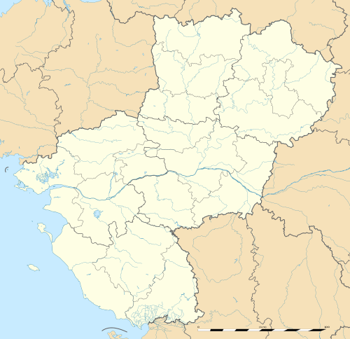
Położenie na mapie Francji
| |||||
| Strona internetowa | |||||


Kraj Loary (fr. Pays de la Loire, ⓘ) – region administracyjny w północno-zachodniej Francji. Nazwa regionu nawiązuje do jego położenia nad dolnym biegiem rzeki Loary. Ośrodkiem administracyjnym jest Nantes.
Graniczy z regionami: Bretania, Nowa Akwitania, Normandia i Region Centralny-Dolina Loary.
Podział administracyjny

W skład regionu wchodzi 5 departamentów[2]:
- Loara Atlantycka (Loire-Atlantique)
- Maine i Loara (Maine-et-Loire)
- Mayenne
- Sarthe
- Wandea (Vendée)
Miejscowości
Największe miejscowości regionu (w nawiasach liczba ludności w 2020 roku[3]):
- Nantes (320 732)
- Angers (155 876)
- Le Mans (145 155)
- Saint-Nazaire (71 887)
- La Roche-sur-Yon (55 213)
- Cholet (54 357)
- Laval (49 617)
- Saint-Herblain (49 067)
- Les Sables-d’Olonne (46 941)
- Rezé (42 993)
- Saint-Sébastien-sur-Loire (27 958)
- Orvault (27 438)
- Saumur (26 154)
- Vertou (25 879)
- Sèvremoine (25 519)
- Beaupréau-en-Mauges (23 465)
- Couëron (22 680)
- Challans (21 900)
- Chemillé-en-Anjou (21 187)
- Montaigu-Vendée (20 578)
- Carquefou (20 463)
- Bouguenais (20 450)
- La Chapelle-sur-Erdre (19 981)
- Mauges-sur-Loire (18 083)
- Segré-en-Anjou Bleu (17 660)
- Pornic (16 886)
- Château-Gontier-sur-Mayenne (16 845)
- Orée-d’Anjou (16 468)
- Loire-Authion (16 293)
- Les Herbiers (16 266)
- La Baule-Escoublac (16 160)
- Guérande (16 042)
- Montrevault-sur-Èvre (15 732)
- Sainte-Luce-sur-Loire (15 417)
- La Flèche (15 078)
- Trélazé (15 056)
Przypisy
- ↑ Estimation de la population au 1ᵉʳ janvier 2024 [online], Institut National de la Statistique et des Études Économiques, 16 stycznia 2024 [dostęp 2024-11-14] (fr.).
- ↑ Région Pays de la Loire (52). Insee. [dostęp 2023-10-16]. (fr.).
- ↑ a b France par commune – Population municipale 2020. [w:] Statistiques locales [on-line]. Insee. [dostęp 2023-10-16]. (fr.).

Content Disclaimer
Informasi ini disarikan dari Wikipedia dan disajikan kembali untuk tujuan edukasi. Konten tersedia di bawah lisensi CC BY-SA 3.0. Kami tidak bertanggung jawab atas ketidakakuratan data yang bersumber dari kontribusi publik tersebut.
- The information displayed on this website is sourced in part or in whole from Wikipedia and has been adapted for the purpose of restating it. We strive to provide accurate and relevant information, however:
- There is no guarantee of absolute accuracy. Wikipedia is an open, collaborative project that can be edited by anyone, so information is subject to change.
- It is not intended to constitute professional advice. The content displayed is for informational and educational purposes only. For important decisions (e.g., medical, legal, or financial), please consult a professional.
- Content copyright. Wikipedia is licensed under the Creative Commons Attribution-ShareAlike License (CC BY-SA). This means that content may be reused with appropriate attribution and shared under a similar license.
- Responsible use. Any risk arising from the use of information from this website is entirely the responsibility of the user.