Misawa
 Siedziba władz miasta | |||||
| |||||
| Państwo | |||||
|---|---|---|---|---|---|
| Prefektura | |||||
| Wyspa | |||||
| Region | |||||
| Powierzchnia |
119,87[1] km² | ||||
| Populacja (2020) • liczba ludności • gęstość |
| ||||
| Kod pocztowy |
〒033-8666 | ||||
Położenie na mapie Aomori 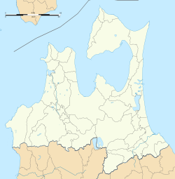 | |||||
Położenie na mapie Japonii  | |||||
| Strona internetowa | |||||


Misawa (jap. 三沢市 Misawa-shi) – miasto w północnej Japonii, na wyspie Honsiu, w prefekturze Aomori[3]. Miasto ma powierzchnię 119,87 km²[1]. W 2020 r. mieszkały w nim 39 152 osoby, w 17 164 gospodarstwach domowych[2] (w 2010 r. 41 258 osób, w 16 142 gospodarstwach domowych)[4].
Miasto jest usytuowane na płaskim terenie w południowo-wschodniej części prefektury Aomori. Jest zwrócone w stronę Oceanu Spokojnego na wschodzie i jeziora Ogawara na zachodzie[5].
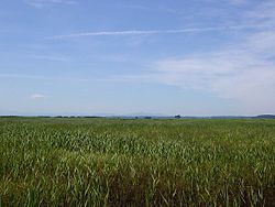
Na obszarze tym znajdują się mokradła Hotoke-numa zarejestrowane na mocy „Konwencji ramsarskiej” (ang. Ramsar Convention on Wetlands) jako obszar wodno-błotny o znaczeniu globalnym[5].
Galeria
-
 Hotoke-numa
 -
 Baza lotnictwa USA w Misawa
 -
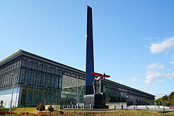 Misawa Aviation & Science Museum
 -
 Komaki Onsen


Przypisy
- ↑ a b Geospatial Information Authority of Japan 2021 ↓, s. 11.
- ↑ a b Statistics Bureau of Japan 2021 ↓.
- ↑ 日本地図. Tokyo: Seibido Shuppan, 2018, s. 147. ISBN 978-4-415-11272-5.
- ↑ Statistics Bureau of Japan 2014 ↓.
- ↑ a b Overview of Misawa City. Misawa City. [dostęp 2020-10-12]. (ang.).
Bibliografia
- Geospatial Information Authority of Japan: 令和3年 全国都道府県市区町村別面積調 (1月1日時点) (Reiwa 3rd year Area adjustment by prefecture, city, ward, town, and village (As of January 1)). gsi.go.jp, 2021. [dostęp 2021-08-16]. [zarchiwizowane z tego adresu (2021-06-05)]. (jap.).
- 2020 Population Census / Basic Complete Tabulation on Population and Households, Table 1-1. e-stat.go.jp Portal Site of Official Statistics of Japan, 2021-11-30. [dostęp 2023-04-29]. (ang.).
- Population and Households of Japan (Final Report of the 2010 Population Census), Table 62. e-stat.go.jp Portal Site of Official Statistics of Japan, 2014-06-27. [dostęp 2023-04-29]. (ang.).
Linki zewnętrzne
- Strona oficjalna miasta (ang.)

| Miasta | |
|---|---|
| Powiaty |
![]()
Content Disclaimer
Informasi ini disarikan dari Wikipedia dan disajikan kembali untuk tujuan edukasi. Konten tersedia di bawah lisensi CC BY-SA 3.0. Kami tidak bertanggung jawab atas ketidakakuratan data yang bersumber dari kontribusi publik tersebut.
- The information displayed on this website is sourced in part or in whole from Wikipedia and has been adapted for the purpose of restating it. We strive to provide accurate and relevant information, however:
- There is no guarantee of absolute accuracy. Wikipedia is an open, collaborative project that can be edited by anyone, so information is subject to change.
- It is not intended to constitute professional advice. The content displayed is for informational and educational purposes only. For important decisions (e.g., medical, legal, or financial), please consult a professional.
- Content copyright. Wikipedia is licensed under the Creative Commons Attribution-ShareAlike License (CC BY-SA). This means that content may be reused with appropriate attribution and shared under a similar license.
- Responsible use. Any risk arising from the use of information from this website is entirely the responsibility of the user.