Jabwot
 Jabwot na zdjęciu NASA z 2001 roku | |
| Państwo | |
|---|---|
| Akwen | |
| Powierzchnia |
0,57 km² |
| Populacja (2011) • liczba ludności |
|
Położenie na mapie Wysp Marshalla 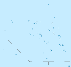 | |
Położenie na mapie Oceanii  | |
Jabwot[1], inne nazwy: Jabat[2], Jabwat[3], (j. marsz: Jebat[3]) – wyspa koralowa na Wyspach Marshalla na Oceanie Spokojnym. Należy do łańcuchu wysp Ralik Chain. Według danych za rok 2011 wyspę zamieszkiwało łącznie 84 osoby (spadek w stosunku do 1999 roku, kiedy to liczba ta wynosiła 95), na wyspie znajdowały się 23 domy[4]. Zlokalizowane jest tu także lotnisko (kod IATA: JAT)[5].
Wyspa została odkryta w 1566 roku[6].
Geografia
Jabwot leży 15 km na północny wschód od atolu Ailinglapalap. Jej powierzchnia wynosi 0,57 km², a największa szerokość 1,2 km[7]. W przeszłości wyspę określano nazwami: Japwat i Tebot[3].
W 1967 r. stwierdzono występowanie na Jabwot 9 gatunków ptaków, w tym 1 lęgowego (kur bankiwa) i 4 potencjalnie lęgowych[8]. Na wyspie spotkać można przedstawicieli gatunku Colocasia esculenta[2].
Przypisy
- ↑ Nazewnictwo Geograficzne Świata. Zeszyt 1. Komisja Standaryzacji Nazw Geograficznych, 2004, s. 143. ISBN 83-239-7552-3. [dostęp 2016-08-01]. (pol.).
- ↑ a b Plant Threats to Pacific Ecosystems: Jabat (Jebat) Island. Hawaiian Ecosystems at Risk project. [dostęp 2016-08-02]. (ang.).
- ↑ a b c Atoll Information--Jabwat Island (Marshall Islands). marshalls digital micronesia, 1998-05. [dostęp 2016-07-29]. (ang.).
- ↑ Economic Policy, Planning, and Statistics Office, Office of the President: The RMI 2011 Census of Population and Housing. Summary and Highlights Only. U.S. Department of the Interior, 2012-02-14. [dostęp 2016-07-29]. [zarchiwizowane z tego adresu (2020-03-02)]. (ang.).
- ↑ JAT - Jabot, MH - Airport - Great Circle Mapper. Great Circle Mapper. [dostęp 2016-07-29]. (ang.).
- ↑ Max Quanchi, John Robson: Historical Dictionary of the Discovery and Exploration of the Pacific Islands. Lanham, Maryland; Toronto; Oxford: The Scarecrow Press, Inc., 2005, s. XX. ISBN 0-8108-5395-7.
- ↑ Marshall Islands - Jabwot. the island encyklopedia. [dostęp 2016-07-29]. (ang.).
- ↑ A. Binion Amerson Jr.: Atoll Research Bulletin No. 127: Ornitology of the Marshall and Gilbert Islands. Waszyngton, U.S.A.: The Smithsonian Institute, 1969, s. 172–176.
| Ratak Chain („Wschód Słońca”, Wschodnie) | |
|---|---|
| Ralik Chain („Zachód Słońca”, Zachodnie) |
![]()
Content Disclaimer
Informasi ini disarikan dari Wikipedia dan disajikan kembali untuk tujuan edukasi. Konten tersedia di bawah lisensi CC BY-SA 3.0. Kami tidak bertanggung jawab atas ketidakakuratan data yang bersumber dari kontribusi publik tersebut.
- The information displayed on this website is sourced in part or in whole from Wikipedia and has been adapted for the purpose of restating it. We strive to provide accurate and relevant information, however:
- There is no guarantee of absolute accuracy. Wikipedia is an open, collaborative project that can be edited by anyone, so information is subject to change.
- It is not intended to constitute professional advice. The content displayed is for informational and educational purposes only. For important decisions (e.g., medical, legal, or financial), please consult a professional.
- Content copyright. Wikipedia is licensed under the Creative Commons Attribution-ShareAlike License (CC BY-SA). This means that content may be reused with appropriate attribution and shared under a similar license.
- Responsible use. Any risk arising from the use of information from this website is entirely the responsibility of the user.